The Pacific Ring of Fire: the origin of the Kamchatka earthquake
27 August 2025

The Pacific Ring of Fire is one of the most geologically active and fascinating regions on our planet.
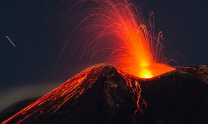
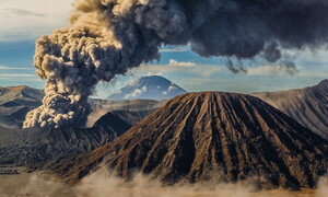
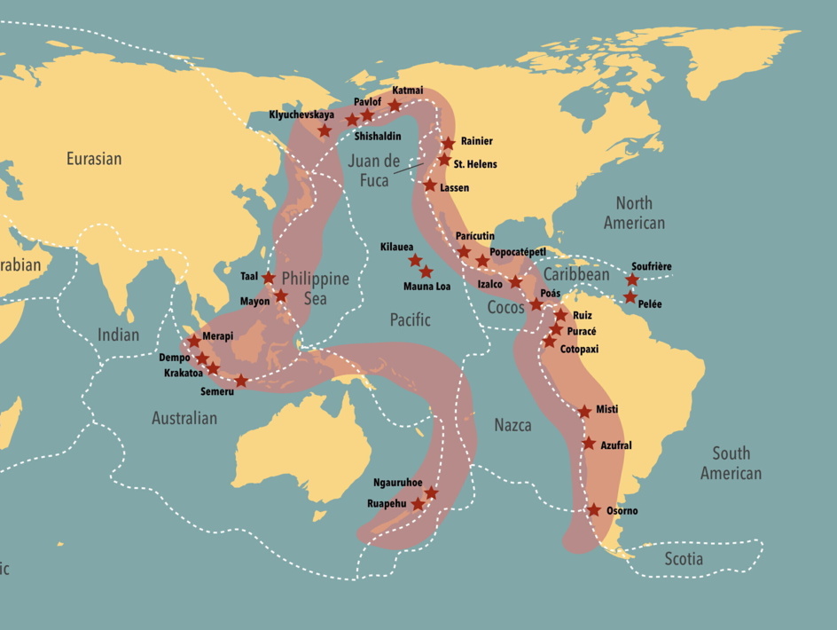
This vast horseshoe-shaped belt, stretching some 65,000 kilometres, encircles much of the Pacific Ocean, extending from southern Chile, up the western coasts of the Americas, across the islands off Alaska, through Japan and down to the Philippines and Indonesia. What makes the Ring of Fire so extraordinary is its remarkable concentration of volcanoes and earthquakes. Around 90% of the world’s seismic activity occurs here, along with about 75% of Earth’s active volcanoes. The cause of this intensity lies in plate tectonics: along the Ring, many oceanic tectonic plates slide beneath continental or other oceanic plates in a process known as subduction. When one plate plunges beneath another, rock material in Earth’s mantle melts, forming magma that rises to the surface and produces often explosive volcanic eruptions. This relentless movement of the plates also generates immense stresses, which are released as earthquakes of varying magnitude—including the planet’s most powerful, capable of triggering devastating tsunamis. Russia’s Kamchatka Peninsula is a striking example of this unceasing activity, serving as a focal point within the Ring of Fire. Just recently, a powerful magnitude 8.8 earthquake shook the region, once again highlighting its dynamic and unpredictable nature. Events like this underscore the importance of studying the Ring of Fire as a giant natural laboratory to better understand volcanic and seismic phenomena, and to improve forecasts of extreme events—crucial for the populations living in these constantly threatened areas.