Global datasets of wind and solar farm locations and power
04 May 2020

A team of researchers from the University of Southampton in the UK has produced the world’s first solar and wind energy map. This tool takes almost all the large photovoltaic parks and wind farms installed on the planet into account and therefore manages to fill one of the biggest shortcomings in the renewable energy field, namely the lack of information on the location of current infrastructures. The new study, published in the Nature’s Scientific Data journal, shows where large solar and wind power plants are located, reporting both regional infrastructure density and power output.
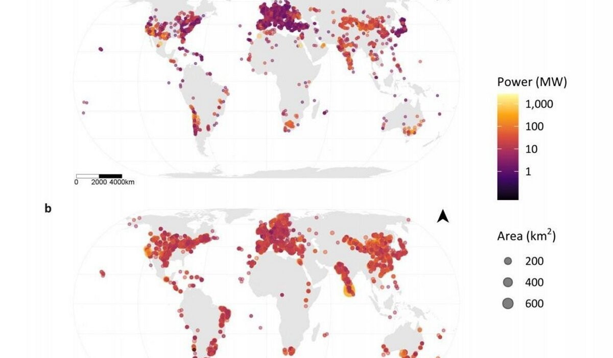
What prompted the researchers to create this gigantic dataset is the lack of geospatial information documenting the rapid expansion of renewable energy technologies. This lack of information does not allow, for example, an assessment and knowledge of the impacts of wind and solar power plants on biodiversity, even at local level. To obtain the map, the research team used OpenStreetMap (OSM), a collaborative, open source global mapping project generated by a community of millions of users. The final map can be used to support a wide range of applications, including analysing the impact of infrastructure on the land and measuring progress towards global energy targets. It can also provide a solid information base for planning future green power plants.