Air in motion

Related topic
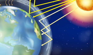
It is difficult to construct a model of atmospheric circulation, because very many factors influence the displacement of masses of air through the atmosphere; however, the fundamental principle is that the gases that make-up the atmosphere tend to seek a condition of equilibrium that implies a uniform distribution of energy, equalizing the temperature and the pressure on the entire planet. The ‘motor’ of atmospheric circulation is therefore given by the redistribution of the energy received from the Sun. Solar radiation, in fact, varies at different latitudes with the result that the equatorial regions are warmer than the polar ones. The atmosphere tends to re-balance this difference moving masses of warm air from the regions where there is an excess of heat towards colder regions, in an attempt to reduce the difference in temperature between the Equator and the Poles.
Differences in temperature bring about immediate differences in the pressure within the masses of air: it is these differences in pressure that cause air displacement. Low pressure areas attract air from areas where the pressure is higher (vedi grafico 10: Alte e basse pressioni). Vice versa, air tends to move away from high pressure areas towards areas with lower pressure. The speed at which this displacement takes place is directly proportional to the difference in pressure between the two points. In ideal conditions, if the Earth were motionless and if there were no friction or obstacles, air would flow perpendicularly to the isobars (the lines that join points with equal pressure), according to the so-called pressure gradient, following a path that makes the air travel along the shortest route from the high pressure area to the low pressure one. However, many factors contribute to deviating the flow of air from the ideal condition.
The Coriolis effect
The Coriolis effect, that gets its name from the physicist Gaspard Coriolis who postulated the theory in the 19th century, is an effect, caused by the Earth’s rotation, that acts on moving bodies on the Earth’s surface. It is also known as Coriolis force, but this definition is incorrect since it is not really a force, even though its effects may appear similar to those of a force to an observer within the system. As a consequence of the Earth’s rotation, any object that travels in a straight line will undergo a deviation in its path that will take it far from the desired point unless it can carry out continuous changes in its course.
High and low pressure
If an isobar chart is observed, it can be seen that pressure is not distributed uniformly in the atmosphere around our planet: there are areas with a lower pressure than the surrounding areas and areas where the pressure is higher. Due to a characteristic of gases, air tends to move from high pressure areas towards those with low pressure in an attempt to balance the difference. The presence of high and low pressure areas is therefore the principal motor of all meteorological phenomena, in other words, of the ‘weather’.
When air masses meet
When a moving cold air mass meets a warm air mass, that is lighter, it tends to wedge below the latter, thus giving origin to a cold front. The warm air is forced upwards and its ascent causes the formation of clouds. Since the surface of contact between the two masses is quite steep and ascent is rapid, the clouds will be prevalently of the cumuliform type. The passage of a cold front is accompanied by widespread cloud systems and precipitations, with a sharp drop in the temperature, an increase in the pressure and precipitations often characterized by thunderstorms.
Circulation cells
Between the Equator up to 30° latitude (N or S), we find the Hadley cell. In the Equatorial region, air is heated and rises, creating a low pressure area. Air would tend to shift towards the N along the meridians, but in the northern hemisphere, due to the Coriolis effect, the flow is deviated towards NE and descends toward the 30° parallel, bringing warm humid air. Once it descends, the air is again drawn towards the Equator due to the low pressure of the area, and this time the air travels from NE to SW, again as a result of the Coriolis effect.
The Coriolis effect
The Coriolis effect, that gets its name from the physicist Gaspard Coriolis who postulated the theory in the 19th century, is an effect, caused by the Earth’s rotation, that acts on moving bodies on the Earth’s surface. It is also known as Coriolis force, but this definition is incorrect since it is not really a force, even though its effects may appear similar to those of a force to an observer within the system. As a consequence of the Earth’s rotation, any object that travels in a straight line will undergo a deviation in its path that will take it far from the desired point unless it can carry out continuous changes in its course.
Related topic
Winds are more or less rapid horizontal displacements of air masses caused by differences in the pressure distribution. Due to the fact that pressure variations are mainly caused by temperature variations, it follows that the wind’s main motor is the divergence in solar radiation in the different regions of the world.
Wind direction. Each wind is characterized by the direction in which it moves and by its speed. Normally, when one talks about wind direction, one means the direction the wind comes from: westerly winds, for example, are winds that blow from the West to the East.
Air masses would tend to move perpendicularly to the isobars, following the pressure gradient, i.e. the difference in pressure that brings about the displacement of masses of air, but the Coriolis effect modifies their course. In ideal conditions in which there is no friction, and in which the pressure gradient force and the Coriolis effect are equal and opposite, winds move parallel to the isobar lines, leaving the high pressure areas to their right in the Northern Hemisphere and to their left in the Southern Hemisphere: these are the so-called geostrophic winds (see the graph “geostrophic winds” for more information), winds that are “ideal” so to speak.
Generally, at ground level, friction with the Earth’s surface causes deviations in the wind’s direction and only winds at an altitude greater than 1,500 m are very similar to geostrophic winds.
Winds at ground level
Winds can be divided into ground level winds, that blow in the lower strata of the troposphere, and high altitude winds. As far as winds at ground level are concerned, different types can be distinguished: local periodical winds, such as coastal and valley breezes, that form as a result of the unequal heating caused by unequal solar radiation, and global winds, whose direction and intensity depend on the distribution of the big pressure cells in the world. The trade winds blow from the subtropical anticyclonic cells towards the equatorial low pressure areas.
High altitude winds
In theory, one might expect ground level winds to be coupled with similar winds, blowing in the opposite direction, at high altitudes, in the higher strata of the troposphere. In practise, however, from observations that have been carried out, it has been shown that above an altitude of 4-5.000 m there are only westerly currents that move from West to East roughly following the route of the parallels. Only above the Equator there is a narrow band of easterly winds that are probably connected to the convergence zone of the trade winds.
The Foehn wind
The name Föhn (or Foehn) comes from the dialect of Tyrol, and indicates a particular type of wind that is characteristic in the Alps, which can also be noted, naturally, in most of the other mountain ranges. It is generated when a moving mass of warm humid air meets a mountain on its path. By inertia, the mass of air moves against the mountain and the air is forced to rise along the sides of the mountain. As it rises, the air cools and expands, thus becoming saturated with water vapour.
Jet streams
Jet streams are particular evolutions of high altitude winds. They are rapidly moving air currents caused by pressure differences that result from the temperature divergences that occur when big air masses meet. They were discovered fortuitously by American aeroplanes flying towards Japan during the Second World War. To be called a jet stream, the wind speed has to be higher than 50 knots, about 90 km/h, however, jet streams usually have much greater speeds ranging from 160 to 250 km/h, with peaks of 320 km/h.
The Coriolis effect
The Coriolis effect, that gets its name from the physicist Gaspard Coriolis who postulated the theory in the 19th century, is an effect, caused by the Earth’s rotation, that acts on moving bodies on the Earth’s surface. It is also known as Coriolis force, but this definition is incorrect since it is not really a force, even though its effects may appear similar to those of a force to an observer within the system. As a consequence of the Earth’s rotation, any object that travels in a straight line will undergo a deviation in its path that will take it far from the desired point unless it can carry out continuous changes in its course.
Related topic
Clouds are formed by microscopic drops of water or by small ice crystals. The size of the droplets generally range from a couple of microns to 100 microns: this is the limit beyond which cloud drops become rain drops. The shape of the drops is usually spherical, but it can vary, especially in bigger drops that are deformed by gravity.
Water in the atmosphere: evaporation and condensation. The evaporation of water bodies and evapotranspiration from soil and vegetation supply the atmosphere with great quantities of water vapour (vedi sezione acqua). Even though it is abundant, the amount of water vapour supplied to the atmosphere by evaporation processes generally is not sufficient to make the air reach saturation point. Saturation and the consequent condensation of vapour into drops of liquid water are therefore generally caused by the cooling of air masses at a temperature below condensation, also known as dew point. When condensation takes place, a part of the excess water vapour changes from the gaseous state to the liquid state, forming microscopic drops of water. For condensation to occur, however, it is not sufficient to reach the dew point: it is necessary that the so-called condensation nuclei should be present. These are small particles (whose dimensions range between 0.001 and 10 micron) on which the tiny drops of water can condense. The condensation nuclei normally present in the atmosphere are sodium chlorides, sulphates, carbonaceous particles and atmospheric dust and can be present as a result of natural causes (as for example, marine aerosols transported by the wind or ashes coming from volcanic activity) or due to human activities (the result of the combustion of fossil fuels, for example). The bigger and more hygroscopic (i.e. capable of attracting water molecules) the nuclei are, the more effective is their role in favouring condensation processes.
If the temperature is low, water condenses in the form of ice crystals, but it still requires the above-mentioned nuclei that, in this case, are called crystallization nuclei.
Cloud formation
Cloud formation is apparently a very simple process, caused by the condensation of atmospheric humidity into drops of water, but in actual fact it is a more complex phenomenon, in which different factors and mechanisms are involved. All the processes however are based on the ascent of a mass of humid air and its successive cooling up to dew point. In this process a body of water or the humidity of the ground evaporate as a result of solar radiation and a volume of hot, humid air forms and slowly starts to rise since hot, humid air is lighter than the air surrounding it.
How they move
The contribution of the Sun: lifting by convection. Solar radiation is the first and most evident cause of the lifting of warm and humid air masses: the air gets heated both by direct absorption of solar radiation (especially in the infrared band, that is preferentially absorbed by water vapour), and by convection above the ground that loses heat.
The contribution of the mountains: orographic lifting. The process is analogous to the previous one, but in this case, the mass of warm and humid air rises because of the topography: when a moving mass of air meets a mountain it is forced to move along its sides, rising and cooling.
Different shapes
The first scientific classification of clouds was made by an English chemist, L. Howard, in 1803, and the classification system that he proposed is, with some modifications, still used today. It is based on two principal groups, divided according to the development (vertical and horizontal) and three types: cirrus, cumulus and stratus clouds. The different combinations of groups and types lead to the different cloud formations.
Different shapes. Stratus (St) clouds, are widely extended horizontal sheets in the lower elevations, and are generally grey.
Different altitudes
Low clouds reach a maximum limit of 1,800 m, while the low limit can even be at ground level. Stratus, nimbostratus, stratocumulus and cumulus clouds belong to this category. Average clouds are to be found at elevations ranging between 2,000 and 6,000 m. Altostratus and altocumulus clouds belong to this category, but at these heights we often find clouds that are moving from the lower layers to the higher ones.
The Coriolis effect
The Coriolis effect, that gets its name from the physicist Gaspard Coriolis who postulated the theory in the 19th century, is an effect, caused by the Earth’s rotation, that acts on moving bodies on the Earth’s surface. It is also known as Coriolis force, but this definition is incorrect since it is not really a force, even though its effects may appear similar to those of a force to an observer within the system. As a consequence of the Earth’s rotation, any object that travels in a straight line will undergo a deviation in its path that will take it far from the desired point unless it can carry out continuous changes in its course.


